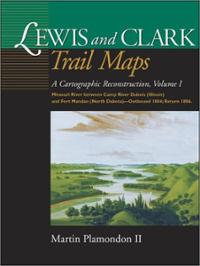
 Author: Martin Plamondon II
Publisher: Washington State University Press – 191 pages
Book Review by: Paiso Jamakar
The main purpose of the very historically-significant Lewis and Clark Expedition, commissioned by President Thomas Jefferson after the Louisiana Purchase in 1803, and named after Capt. Meriwether Lewis and 2nd Lt. William Clark of the United States Army, was to find a safe route to the Western portion of the then geographically-expanding country.
Known also as the Corps of Discovery, the two leaders of the expedition were to map the newly-acquired territory. Their plan was to follow the Missouri River in the central United States all the way northwest to find out if it connected, or came close enough, to the Columbia River which flowed to the edge of land and flowed into the Pacific Ocean.
A larger goal of the Lewis and Clark Expedition was to firmly establish an American presence in this territory before Britain and other European powers tried to claim it.
That journey of over 7,000 miles began in May, 1804 and lasted until September 1806. The starting point was Camp Dubois near St. Charles, Missouri, which is part of present-day Kansas City.
There were economic and scientific objectives as well that included studying the area’s natural resources such as plants and animal life. Many rivers and lakes were discovered in the course of this historic expedition.
The explorers met with members of various Indian tribes, many of whom they traded with and obtained useful information from. Firearms were very useful in encounters with the Indians as they were as they were very desirable trade items in the West.
With lots of maps, sketches and journals in hand, Lewis, Clark, and the other members of the expedition returned to St. Louis in September 1806 to report their findings to President Jefferson.
This large, hardbound, high-quality volume containing 160 full-page detailed maps and trails created by professional cartographer Martin Plamondon II of that historic journey is a highly informative and extremely useful record book for cartographers, ecologists, geographers, historians, map-makers, and anyone interested. It is a very good teaching tool for our youth, especially students in our schools.
The frontier land that the explorers discovered and traversed through has dramatically changed in the 200-plus years since that journey, the author points out. He writes: “The landscape along the Lewis and Clark Expedition route has been so greatly altered by the course of nature and the hand of man that it is impossible today to view most of the trail as the Corps of Discovery saw it.”
He cites numerous changes, some of which are:
- “On the Missouri and Columbia rivers, along where the explorers in 1804-06 struggled mightily against swift currents, treacherous rapids, and shifting sandbars, there often now exist placid lakes.”
- “Twenty-four major dams along the route have created over 1,200 miles of reservoir waters.”
- “Cities, towns, railroads, highways, airports, pipelines, industrial complexes, dikes, water and sewage treatment plants, modern forestry practices, transmission lines, farms and homes intrude on much of the trail.”
- “The course of the Missouri River from its mouth to mid-Montana has naturally changed hundreds of times since the Corps of Discovery fought its currents.”
Besides the useful maps that fill much of this book, Plamondon also provides historical accounts on some of the topics related to that journey
- Expedition Surveying
- Camp River Dubois Winter Encampment 1803-04 (with sketch of living quarters)
- Captain William Clark
- Clark’s Mapping Efforts
- Constructing the Lewis and Clark Trail Maps
- A Brief History of the Expedition
- Fort Mandan, Winter Encampment, 1804-05 (with a drawing)
As a well-researched book with about 160 detailed maps and many important aspects of the historic Lewis and Clark Expedition that helped in the geographic and demographic expansion of the United States, this book by Mark Plamondon II is an extraordinary contribution to our understanding of that great event. We congratulate him on this outstanding achievement.
Martin Plamondon II of Vancouver, Washington, is a former county director of mapping and served as chairman of the Governor’s Washington Lewis and Clark Trail Committee. His long-term research in exploration history and twenty-eight years of experience as a professional cartographer provide the exceptional skills required to complete the trail maps.


